Information
Organiser's Description
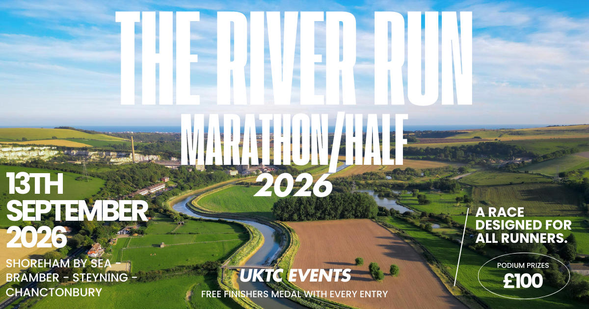
The upcoming River Run marathon and half marathon, starting in Shoreham-by-Sea by the rivers edge, offers runners the chance to experience the breathtaking beauty of the British countryside. The route follows the peaceful River Adur, winding along the River path through charming areas like Bramber and Steyning, giving participants a picturesque and serene running experience without repeating paths. The Half Marathon will head back on the opposing side of the river after working your way up and around Bramber behind the castle ruins and back to Shoreham.
Those taking on the full marathon will enjoy an added challenge, venturing onto the stunning South Downs towards the historic Chanctonbury Ring, where they'll be rewarded with incredible panoramic views of the rolling hills and surrounding landscape. This scenic course perfectly showcases the natural beauty of the region, making it a truly memorable event for runners of all levels.
Start Adur Recreation Ground.
• Accurately measured course
• Bespoke Medals supplied - Trophies and cash prize for first 3 runners
• Toilets on site.
• Water at various parts of the course
• Fully stocked themed aid stations such as a Tea House inspired stop in Bramber as well as unique stocked up food/drinks stations.
• Terrain: Pathway and Trail.
• Timing Chipped for accurate results.
• Complimentary Finishers T-Shirt.
• Food Trucks and Seating for spectators.
• Marshalled Course.
Route and elevation
The marathon and half marathon course offers a mix of flat and hilly terrain, providing a scenic yet varied challenge for runners. Here’s a breakdown of the elevation details:
Half Marathon:
Mostly Flat: The half marathon follows the River Adur, primarily on both sides, making it a relatively flat and fast course. With minimal elevation change, runners can expect a scenic, peaceful run through the countryside without major climbs, making it ideal for those seeking a steady pace.
Full Marathon:
Gradual Ascent to the South Downs: While the first half of the course shares the flat riverside paths with the half marathon, the full marathon ventures up towards the South Downs after passing Bramber and Steyning.
Challenging Elevation Near Chanctonbury Ring: As runners approach Chanctonbury Ring, the terrain becomes more challenging, with a steady climb up onto the Downs. The ascent offers stunning views of the surrounding countryside but will test runners’ endurance.
Return Descent: After reaching the high point at Chanctonbury Ring, the course offers a descent back down toward Shoreham-by-Sea, providing a more manageable run on the return leg.
What's Included
Before Race Day
You will be able to pick up your race packs in the week leading up to the event and on race day itself.
- Includes your Running number, race guide, timing chip and other goodies.
- Trail running map of the course so you can become familiar with the route you will be running on race day. This will be available as a link via Strava.
Race Day
- Podium Prizes
- Awesome Aid Stations
- Live Commentating as you finish your race.
- Large supergraphics and selfie props to grab an awesome photo by yourself or with your race team.
- Portable loos on site.
- A finishers medal when you finish your race.
You will receive a briefing of the event and be given any information that may have changed on the day about the event such as the condition of the trail/run.
Cut offs
Marathon registrants must be capable of completing the full distance, start to finish, within 7 hours. The course will close at this pace.
Half Marathon registrants must be capable of completing the distance within 4 hours.
Start waves
Participants will be assigned to their zones based on which events they will be taking part in. Predicted times can be submitted on sign up.
Participants must assemble in their assigned starting zones no less than 15 minutes prior to the race start. If for whatever reason you want to run in a different starting pen on race day you can as these are not strictly enforced, it is for us to reduce congestion along the paths.
Participants must begin the event during the official start times, positioned behind the start line.
How to Get There
By Car:
Address: Adur Recreation Ground, Brighton Road, Shoreham-by-Sea, BN43 5LT.
From Brighton (East): Take the A259 westbound towards Shoreham. After crossing the River Adur, continue on Brighton Road, and the entrance to Adur Recreation Ground will be on your left.
From Worthing (West): Take the A27 or A259 eastbound toward Shoreham. Follow signs for Shoreham-by-Sea and turn right onto Brighton Road. The entrance will be on your right after passing the bridge over the River Adur.
By Train:
Shoreham-by-Sea Train Station is approximately a 10-15 minute walk from the Recreation Ground. You can take a direct train to Shoreham from Brighton, Worthing, or London Victoria.
Exit the station and head south toward the roundabout. Cross the bridge over the River Adur and turn left onto Brighton Road. Continue walking along the riverbank until you reach the Recreation Ground on your left.
By Bus:
Local buses from Brighton, Worthing, and surrounding areas stop near Shoreham town center. The most common routes are:
Route 700: Coastal bus service from Brighton, Worthing, and Littlehampton. Get off at Shoreham High Street and walk across the bridge to Brighton Road, where the Recreation Ground is located.
On Foot or by Bicycle:
The Recreation Ground is located along the River Adur, with walking and cycling paths leading from Shoreham town center, as well as nearby towns like Steyning and Lancing. Simply follow the riverbank paths towards the Brighton Road bridge.
Parking
If you're looking for parking near Adur Recreation Ground in Shoreham-by-Sea, here are several nearby options:
1. Adur Recreation Ground Car Park (On-Site)
Location: Brighton Road, Shoreham-by-Sea, BN43 5LT.
Details: This parking will be used just for the event staff and emergency services on the day.
2. Shoreham Beach Car Park
Location: Beach Green, Shoreham-by-Sea, BN43 5LT.
Distance: A 5-10 minute walk across the pedestrian bridge over the River Adur.
Details: A large public car park with plenty of space, perfect for accessing Adur Rec via the footbridge.
3. Ropetackle Car Park
Location: Little High Street, Shoreham-by-Sea, BN43 5EG.
Distance: About a 10-minute walk from Adur Recreation Ground, just across the river.
Details: Pay-and-display car park near Shoreham town center.
4. Tarmount Lane Car Park
Location: Tarmount Lane, Shoreham-by-Sea, BN43 6BJ.
Distance: A 10-minute walk from the Recreation Ground.
Details: Close to the high street, this car park is convenient for walking to the event via the pedestrian bridge over the River Adur.
5. Buckingham Road Car Park
Location: Buckingham Road, Shoreham-by-Sea, BN43 5UD.
Distance: About a 12-15 minute walk from Adur Recreation Ground.
Details: A slightly further option but still within walking distance, located near the train station.
6. Street Parking
Location: Some streets in the residential area around Shoreham have on-street parking, though restrictions may apply.
Details: Be sure to check signage for any time limits or fees.
For all car parks, early arrival is recommended, especially during events, as spaces can fill up quickly.